3D model with photogrammetry
An unbeatable tool for sales and marketing – for industries, municipalities and tourism
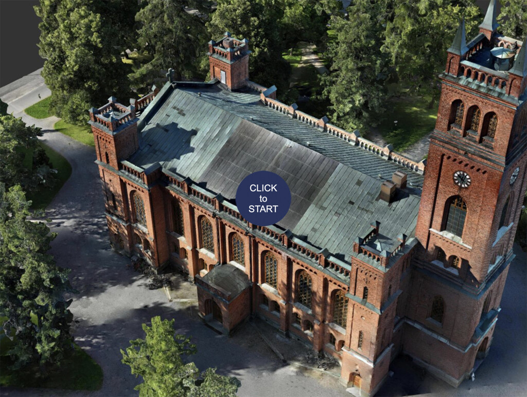
Photogrammetry is a 3D modeling technique based on photography. It allows for the creation of highly accurate 3D models from photographs taken in an area. Photogrammetry is not a recent invention, but it has evolved tremendously in a short period of time. Now, it can produce more accurate 3D models than traditional lidar scanning. In the 3D model we captured from an industrial area spanning hectares, the margin of error was only 4 cm.
Orthophotos produced with photogrammetry for land surveying and planning
From the same material produced with photogrammetry, in addition to a 3D model of the area, orthophotos can be generated. An orthophoto is a high-resolution aerial image without ground distortions. The aerial image is composed of multiple photographs taken by a drone, which are stitched together and geometrically corrected to match a map or plane coordinates.
Orthophotos are an excellent tool, especially for urban and municipal planning of new residential or industrial areas. They offer a cost-effective method for land surveying, mapping, and environmental planning.
Construction companies can also benefit from orthophotos by incorporating them into their design software. This allows for calculations, such as the amount of topsoil materials needed for earthworks, and the ability to start modeling buildings within the design software.
Highly accurate 3D model enables reliable measurements and condition assessments
Photogrammetry can produce very precise and detailed orthophotos and 3D models of even large industrial areas. From the modeling, precise area and distance measurements can be conducted. Condition assessments of surface structures can be carried out without the need for physical presence on-site, as the detailed model allows for checking the condition of hard-to-reach structures like roofs and other inaccessible areas. The entire model can also be transferred into a CAD design environment, where, for example, an old warehouse on an industrial site can be demolished and a new building can be modeled in its place.
In volume measurements, accuracy reaches below a cubic meter. Mass inventory conducted with photogrammetry is more accurate and cost-effective compared to manual and machine-assisted methods.
Using photogrammetry and enrichments for a completely new virtual tour as a sales asset in tourism
A 3D model created with photogrammetry that can be interactively explored in a web browser is already an impressive and distinctive way to showcase an area.
However, it can be further enriched with embedded videos, text, links to reservation systems, and even 360-degree virtual tours! In this case, the photogrammetry-produced aerial panorama view, accessible in a web browser, serves as the starting point for the virtual tour.
Buildings within the area can be clicked on, allowing users to immerse themselves in a 360-degree panorama from the correct perspective. This approach provides incredibly informative presentations tailored to both tourists and enthusiasts, showcasing areas such as campgrounds, amusement parks, golf courses, and ski resorts.
Embedded 360° virtual tours take photogrammetry-generated aerial panoramas to the next level
We are one of the first commercial panoramic photographers and virtual tour creators in Finland. We have extensive experience in providing photography services to industrial and service sector businesses. The quality of the virtual tours we deliver is top-notch, and we are capable of producing them for large spaces as well.


